
Applied Fieldwork
Qualitative and Quantitative data

Qualitative data is an opinion, in which people think or feel.
i.e how round the pebbles are
Quantitative data is fact, information that can be written down in numbers.
i.e the angle of the slope of the beach
i.e how round the pebbles are
Quantitative data is fact, information that can be written down in numbers.
i.e the angle of the slope of the beach
Primary and Secondary data
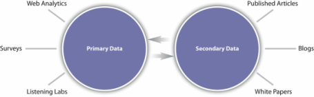
Primary data is data observed or collected directly from first-hand experience.
i.e pebble size, angle of slope
secondary data is published data and the data collected in the past or other parties.
i.e data found from a map, data found from a textbook
i.e pebble size, angle of slope
secondary data is published data and the data collected in the past or other parties.
i.e data found from a map, data found from a textbook
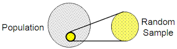
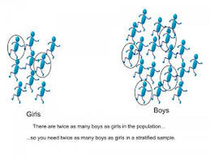
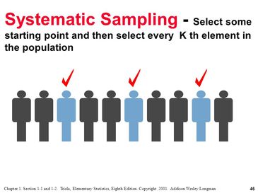
Random, stratified and systematic data
|
Random data is when you take readings from with no systimatic pattern, take it randomly.
i.e In a flat grassy field, you could assume that the environmental conditions do not change within the meadow, therefore it wouldnt matter where you took the data from. You could use a random number generator to determine where. stratified data is used when the study area includes significantly different parts (also known as subsets). i.e In a drainage basin that is 30% clay and 70% sandstone, you may choose to collect data from 3 sites on clay and 7 sites on sandstone. systematic data is used when the study area includes an environmental gradient. i.e angle up a slope every 3 meters |
|
Transects
A transect is a straight line or narrow section through an object or natural feature or across the earth's surface, along which observations are made or measurements taken.
How We Collected Our Data
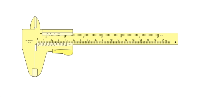
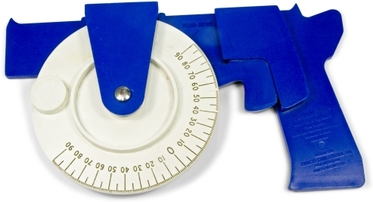
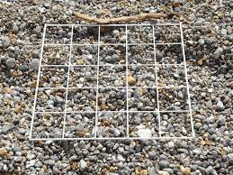
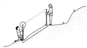
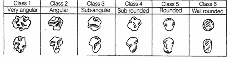
We too a tape measure from the sea to the edge of the path in a perpendicular line from the coast. Using systematic data we measure the angle change every 3 meters. We put meter ruler sticks at every 3 meters and measured the angle by using a clinometer gun. We also measured the length, height and width of pebbles every 3 meters. We measured this using calipers(Cm). Then the volume of pebbles was measured by putting them in water and measuring the difference when the pebbles were in the water. Using a quadrat collected an even spread for the pebbles and took one pebble from the top, one from the middle and one from the bottom. We also recorded the roundness of the pebbles using a chart.
|
|
|
|
How Accurate Was Our Data
Our data was fairly accurate but it could have been made more accurate for example we could have measured the pebbles in mm rather than cm for a more accurate answer. Also the roundness of the pebbles was made on judgement (Qualitative data) and not on fact (Quantitative data).
Hypothesis
The longshore drift is not going from west to east
Conclusion
From the data we can see that the longshore drift is going from west to east because the data from furthest west is low down at 3m high, whereas the data second furthest east is high up at 7.5m high. (furthest west can be excluded as an anomaly). This is because the groynes have collected sand and shingle from the longshore drift.
